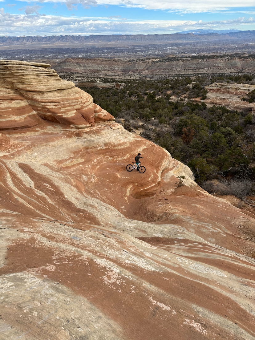
Lunch Loops earned its reputation and it’s not going anywhere. This is the trail system that put Grand Junction on the mountain biking map: chunky, technical, and sitting right at the edge of town. You can be on the trail in 15 minutes from downtown.
It took time to work up to it. Most riders who move to GJ start at 18 Road or Kokopelli, build some confidence, and then eventually make their way to Lunch Loops. That’s the right progression. The system rewards patience and punishes overconfidence. But it also has more range than its reputation suggests. There are blues and even some approachable lines for riders still developing, and if something feels too big, you can always hike your bike through a section. No shame in it.
Pete-e-kis is a blue uphill climb that’s harder than its rating implies. It has a way of telling you exactly where your cardio is on any given day. It’s become a personal benchmark: ride it well and you’re in good shape. Struggle on Pete-e-kis and you know what to work on.
The blacks are where Lunch Loops really opens up. Gunny Loop is the standout: it flows better than most trails at this difficulty level and rewards clean, committed riding. Holy Cross is right there with it. Together, Gunny and Ribbon make one of the best shuttle rides in the valley. Different enough to feel like two separate experiences, good enough that you’ll want to do them back to back.
Navigation at Lunch Loops is genuinely tricky at first. The trail network is dense and intersections can be confusing. Download Trailforks before you go and actually use it. Even regular riders here occasionally find themselves on the wrong trail. That’s not a knock on the system. It’s a feature of a place with enough trails to explore for years.
Knowing when not to ride matters as much as knowing what to ride. The soil at Lunch Loops has bentonite clay that becomes slick and rutted when wet. After rain, or after afternoon snow melt, it needs to dry completely before you put tires on it. The Grand Junction MTB Trail Conditions Facebook group is where locals post real-time updates — more reliable than any app and checked by people who actually went out there.
Getting there, parking, and season
The main lot is the Tabeguache Trailhead on Monument Road, about 1.8 miles off Highway 340, with restrooms and an info kiosk. There is no official overflow lot, and the main one fills almost any nice day. What I actually do is park at the regular lot next to the bike park, or grab one of the parallel spaces across from the Dynamite Shacks bouldering right beside it, since I am usually out there to ride and to boulder both. When the lots are full, the better move is to skip them and ride in on the paved Monument Connector path from the Riverfront Trail. The Little Park Road trailhead is worth knowing, but it only helps for the upper trails like Gunny Loop, Ribbon, and Andy’s Loop, not the bike park or the lower loops.
Spring and fall are the prime windows. Summer works if you are on the trail by sunrise, since the south-facing rock bakes by mid-morning and there is almost no shade out here. Winter riding happens between storms once the ground dries. Carry more water than you think you need, because there is none on the trail, the exposure is constant, and the dry air hides how fast you are losing it.
The Trek Store nearby is where a lot of local riders get their first real bike. Logan, who helped build the GJ riding community out of that shop, now runs 12 Speed downtown. Worth knowing if you need work done or want a local recommendation on where to ride next.
COPMOBA (Colorado Plateau Mountain Bike Trail Association) is the nonprofit behind trail advocacy and development across the region. They’re the reason a lot of this riding exists and keeps expanding.